We had SO MUCH going on today, I'll probably not be able to get it all down tonight as the Internet connection isn't too great, but I'll get down what I can and come back to fill in the rest later (another day).
The short story is we had smoke, mountain ranges, mountain passes, rain, over sized vehicle roadblocks, winds gusting to 40+ MPH and temps from 54 to 88! It was a real challenging riding day.
Our day dawned somewhat as usual, except that when we went to load the bikes, there was a distinct pall of smoke filling the air. You could see it and smell it. It, of course, was smoke from the nearby Rim Fire as has been making the news all week. Our hotel was loaded with fire fighters, all of which were gone by the time we went out to load at 6:30 AM!
We were on the road at 7:17 AM and headed out to pick up CA-4 which would take us through the Sierra Nevada Mtn Range, and the first 2 of several mountain passes for the day. As we began our climb up the mountains the smoke thickened and not only affected visibility, but was causing physical symptoms like burning eyes, headaches, and sore throats. We really were hoping it would thin out before too long. It did vary some but it hung thick enough to be troublesome all the way through to lunch time at Fallon, NV some 53 miles from our days start!
 |
| Smoky air as we headed out towards CA-4 |
 |
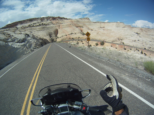
| The first of MANY summit passes this day |
 |
| Mosquito Lake - at Pacific Grade Summit |
 |
| Smoke fills the air looking towards the east (from Pacific Grade Summit) |
 |
| Looking Southwest from Pacific Grade (towards where the Rim Fire is burning) |
 |
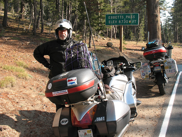
| Ebbetts Pass - in the Sierra Nevada Range |
 |
| Still smoky on US-50 before Fallon, NV |
Before I get much further, let's look at some of the details or our trip today -
 |
| Route taken today from Sonora CA to Ely, NV |
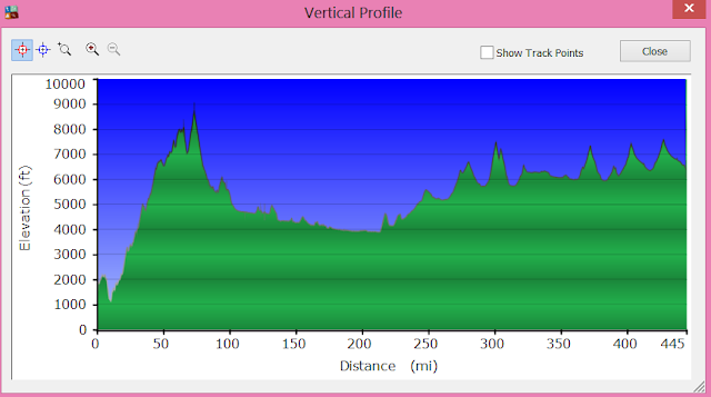
I mentioned going over mountains, so here is the elevation profile of our days trip:
 |
| You can see that we spent almost all of the day above 4000 feet elevation and went up and down 1000 feet several times |
Mountain Summary:
We crossed over five mountain ranges, which included nine named mountain
passes, all of which were over 6000 ft elevation!
Sierra Nevada Mountain Range -
CA-4 Pacific Grade Summit - 8050 ft
Ebbetts Pass - 8732 ft
Desatoya Mountain Range -
US-50 New Pass Summit - 6340 ft
Toiyabe Mountains -
US-50 Austin Summit - 7884 ft
Hickison Summit - 6594 ft
Diamond Mountains -
US-50 Pinto Summit - 7382 ft
White Pine Mountains -
US-50 Pancake Summit - 6521 ft
Little Antelope Summit - 7438 ft
Robinson Summit - 7539 ft
We fueled up in Carson City UT, just prior to starting on our Challenge route - US-50 from Carson City UT to Ely NV. Smoke was still an issue, but we were ever hopeful. We also planned to stop in Fallon, NV for lunch because the timing was right and it was the last real city we'd see before getting to Ely, NV which was some 320 miles from Carson City. When we rolled into Fallon we found a Burger King for lunch and by the time we got back out on the road we were seeing some real improvement in the smoke situation - and none too soon for us. Larry was complaining about a headache and burning eyes, and I had a sore throat and burning eyes.
 |
| Finally starting to clear as we get away from Fallon, NV - over 55 miles from our start today! |
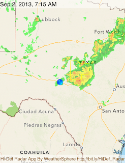
We made some nice time across US-50 from Fallon to Eureka, but Just before we reached Euraka we had to stop and put on our rain gear. We could see dark clouds out ahead and Larry's GPS radar showed us heading right through a thunderstorm. Luckily, as Murphy's Law of motorcycling goes, though we did hit some rain it was only moderate and only for about 15 minutes or so. Still we were glad to have put on the gear because the temps plummeted by some 20 degrees as a result of the rain. Even after it stopped we kept the gear on as we headed into Eureka and then we found our next challenge - As we were coming out of Eureka we came up fast on a lot of flashing lights and stopped cars. Turns out there was a caravan of three semis hauling three oversize loads of those really huge mining dump trucks. They had at least 4 pilot vehicles in attendance as well as a Nevada Highway patrol car making sure nobody tried to pass them as they crept (literally 10 MPH or LESS) up the steep grade of what would be the Pinto Summit (Elev. 7382 ft). We really couldn't believe that they would block all traffic for as long as it was going to take, but they held us up for some 12 minutes as they traveled just 2 miles up to the pass where, thankfully, they bunched up and pulled over in a turnout and the Highway Patrol waved the waiting vehicles around! We were ever so grateful as it had started to really warm up and we were starting to sweat in our rain gear. So we're now past the rain and the traffic jam and looking for some place to pull over and get out of the rain gear. That's when we noticed two more Nevada Highway Patrol cars were forcing all oncoming traffic off to the side of the road in anticipation of the oversize loads coming through. Man those folks were goaing to have a LONG wait! We held off on the gear change for as long as we could but finally found a spot to stop. We worked quickly as it appeared the rain was coming in towards up from behind. In fact, just as we were mounting to start again we felt some cool drops!
We did manage to get away from that rain, but almost immediately we came around a bend and got SLAMMED with very gusty winds from our right side (the south). Turns out there was another thunderstorm just to our south and the outflow boundary from it was funneling right into our sides. We were both leaned well over to 45 degrees and hanging on for dear life. Really, we're both very experienced riders and this was about as difficult riding as we've ever done. Thankfully, we ran about 5 miles or so before we got into another mountain range and it blocked out some of the winds. After that it was pretty clear sailing right into Ely, though we had one more threat of rain as we approached, though it never came into our path.
Stats for today: 444.6 miles in 7:57 moving time, 9:48 Elapsed time.
What a day!
Added GPS Track for the day:


